Launch Your OwnNear Space Satellite
Design, Build, Test and Launch a Real High Altitude Balloon Satellite to the Edge of Space — reaching 30–50 km altitude, above 99% of Earth's atmosphere.
Real Space Technology
Education for Future Engineers
Smartcircuits Innovation Pvt. Ltd. is an applied research lab focusing on R&D and training in Space Sciences, Astronomy, Rocketry, Satellite design & launch, Electronics, Robotics, AI, IoT, and emerging technologies.
Our Near Space Satellite Program gives students hands-on experience designing, building, and launching a real satellite that travels to the stratosphere — above 99% of Earth's atmosphere — reaching altitudes of 30–50 km.
🎯 Mission Goal
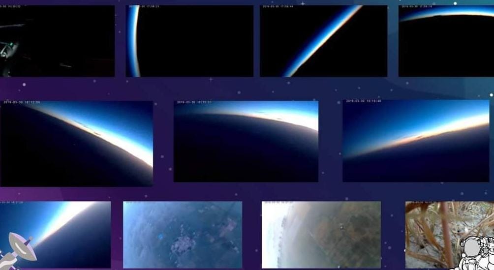
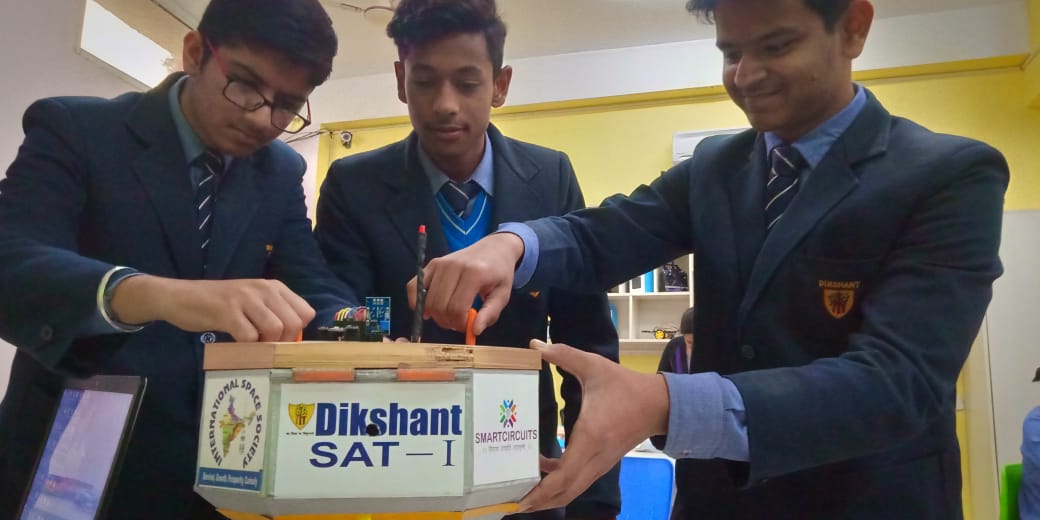
Students design and launch a HAB (High Altitude Balloon) satellite carrying custom sensors, GPS, camera, and telemetry systems to the edge of near space — experiencing -50°C temperatures and pressure 1/100th of sea level.
Satellite Development
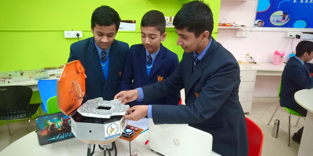
Build a real CubeSat-standard satellite with aluminium structure and space-grade components including OBC, EPS, and communication systems.
HAB Missions
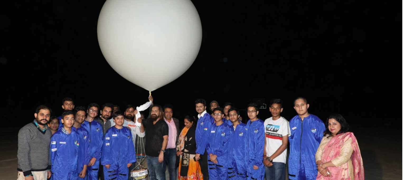
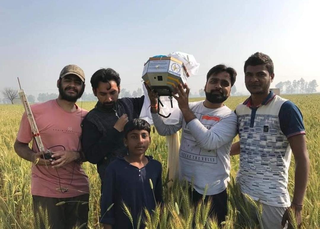
Helium balloons carry your satellite payload to 30–50 km altitude, staying aloft for 2–5 hours in the stratosphere.
Ground Station Ops
Track your satellite live using GPS + GSM, receive telemetry data via LoRaWAN radio frequency transmission.
Scientific Experiments
Conduct atmospheric research measuring temperature, pressure, humidity, UV radiation, and more in near space.
What You'll Build & Launch
Eight core mission pillars that make this the most comprehensive student aerospace program available.
Near Space Satellite vs Orbital Satellite
The smarter, faster, more accessible path to real space mission experience for student teams worldwide.
How Your Mission Takes Flight
From helium balloon to ground recovery — the complete HAB satellite mission flow.
Balloon
Phase
Payload
Burst
Descent
Station
Analysis
Space-Grade Components
Every component in your satellite is modelled on real aerospace specifications, giving you genuine engineering experience.
Your 6–8 Month Mission Journey
A structured journey from zero to launch — guided by expert mentors at every phase.
Guided by Global Space Experts
Learn directly from professionals at the world's most prestigious space agencies and research institutions.
Numbers That Define the Mission
From Lab to Near Space
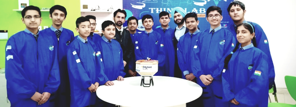
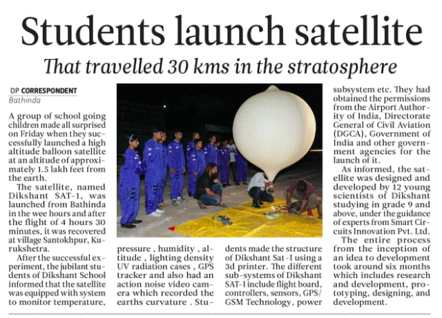
Real missions, real students, real results — India's first school-launched high altitude balloon satellite.
What the World Is Saying
Become Part of the
Next Generation Space Mission
Your school, university or organization could be the next to launch a real satellite. Join India's most advanced student aerospace program today.